


UNESCO Global Geoparks are single, unified geographical areas where sites and landscapes of international geological significance are managed with a holistic concept of protection, education and sustainable development. Their bottom-up approach of combining conservation with sustainable development while involving local communities is becoming increasingly popular. A UNESCO Global Geoparks is an international designation that promotes a balance between man and nature and belong to the International Geoscience and Geoparks Programme (IGGP).
![]()
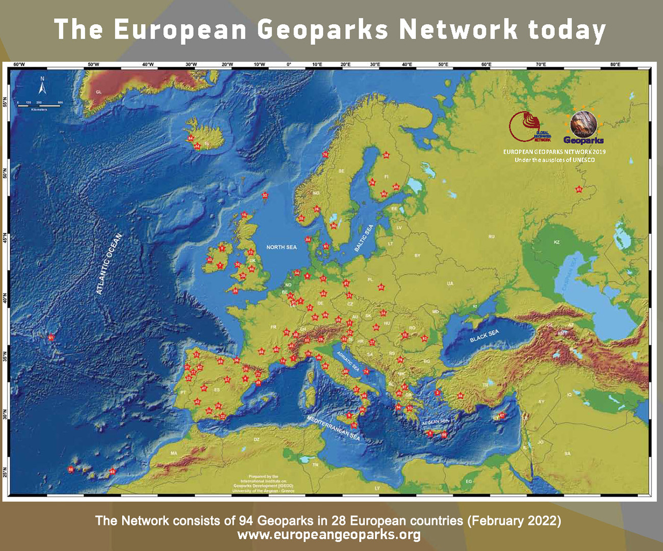
The European Geoparks Network (EGN) has been established in 2000 by four pioneer's geoparks, unfer the auspicies of UNESCO since 2001. It is a very active network that gathers all the UNESCO Global Geoparks in Eurupe.
Audemars Piguet Replica Watches
![]()
The GGN was initially founded in 2004 as an international partnership developed under the umbrella of UNESCO and serves to develop models of best practice and set quality-standards for territories that integrate the protection preservation of Earth heritage sites in a strategy for regional sustainable economic development.
Naturtejo UNESCO Global Geopark was the first Portuguese Geopark, joining the European Network and Global Geoparks under the auspices of UNESCO, in 2006. In 2015 received the UNESCO Global Geopark designation, under the International Geoscience and Geoparks Programme.
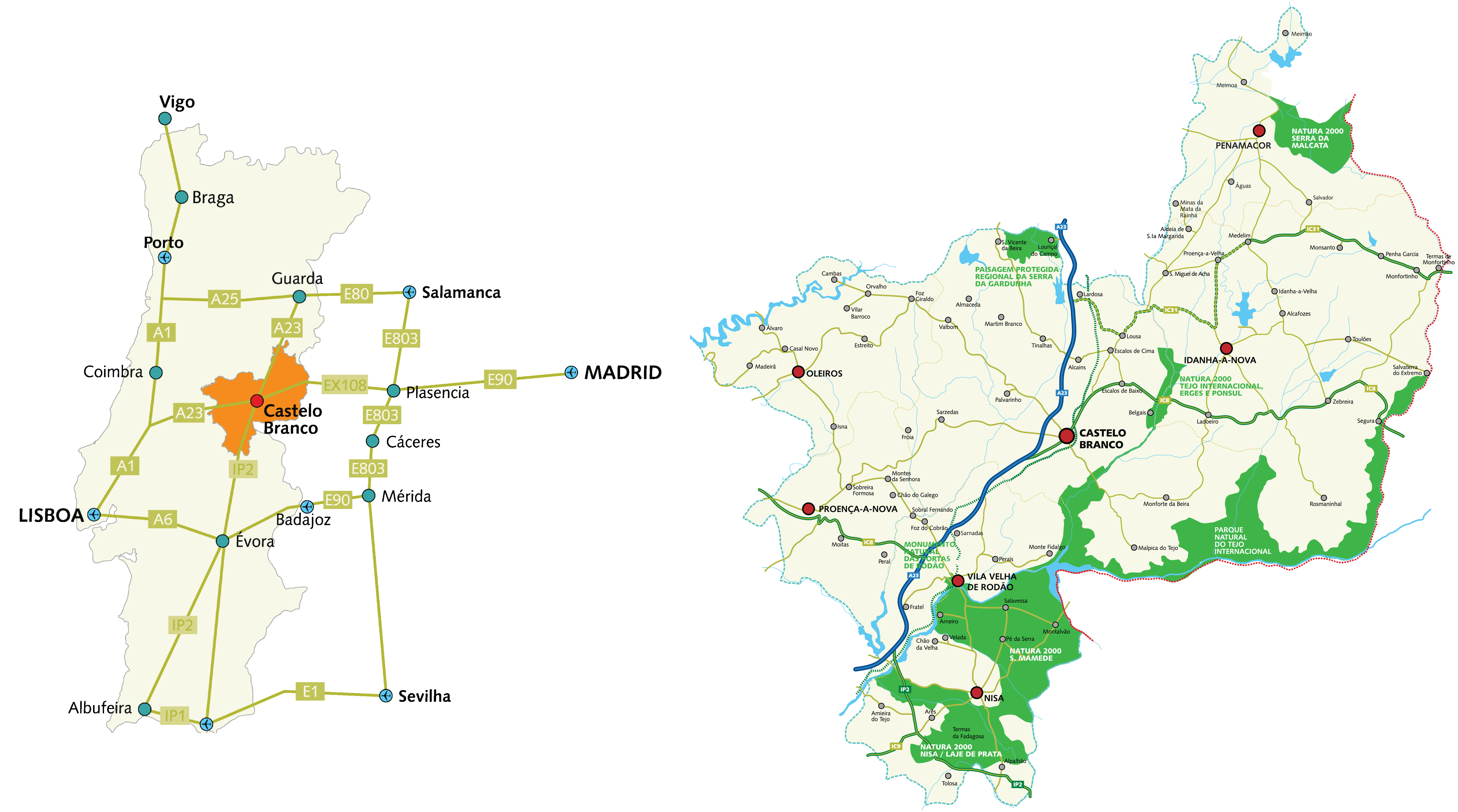
It is a territory of 5067 km2, including 7 municipalities: Castelo Branco, Idanha-a-Nova, Penamacor, Proença -a-Nova, Nisa, Oleiros e Vila Velha de Ródão. Naturtejo Geopark is a landscape of geodiversity, where magnificent quartizte montain ridges and inselbergs are erected. It is covered with cork and holm oaks, pine trees in mountain areas and rock rose and rosemary are abundant. A landscape full of history, with Templar and Hospitallers Castles, and old villages with a strong medieval environment at the border yet; the schist villages of slate that spread in the valleys of the Central Mountains Belt, where the most vivid memories of an ancestral rurality experience show up. It is a territory of conservation, education, tourism, innovation and sustainable development.
Geodiversity of the Naturtejo Geopark
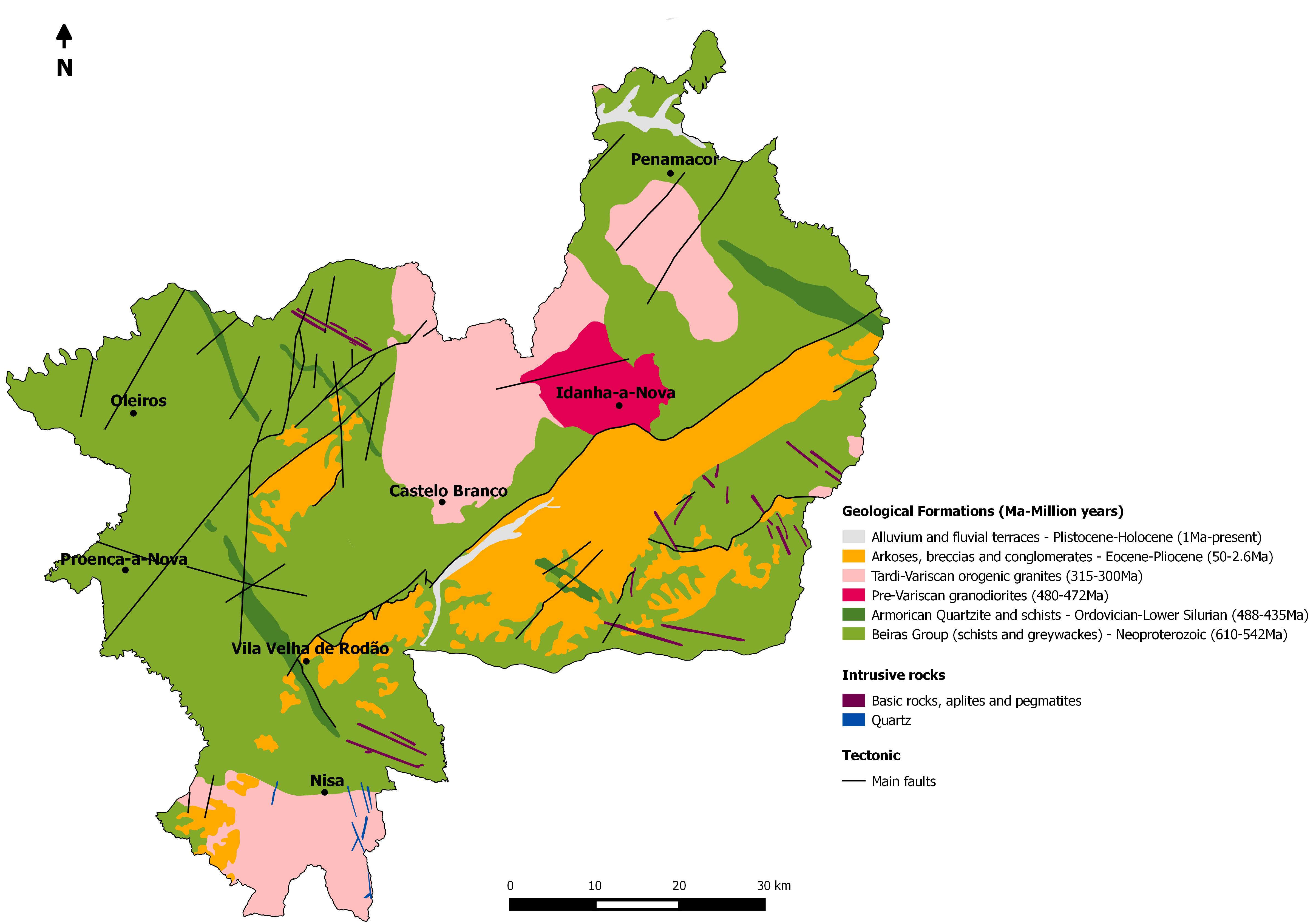
The starting point for the regional development of the entire territory is geodiversity, the unifying element of a region with great cultural diversity. There are 600 million years of Earth’s memory written in the rocks, fossils and landscapes.
Naturtejo Geopark presents a landscape that tells the story of the last 600 million years, through elements such as flattened vast areas in which erupted residual granite reliefs (Monsanto), sedimentary (Murracha, Murrachinha, Pedras Ninhas) tectonic alignments (fault scarp of the Ponsul , Sobreira Formosa) and quartzite ridges (Penha Garcia, Ródão, Moradal, Monforte da Beira). The highlands are still cut by deep incision of the hydrographic network of the Lower Tejo.
The large geodiversity of the Geopark Naturtejo reflected in a significant number of sites of geological interest, with 176 geosites of which 17 geomonuments, key places for the interpretation of the geology and which have monumental characteristics.

Landscape Museum
www.roteirodeminas.pt
Guide of the Portuguese Geological and Mines Sites.

Center of Portugal Tourism
Discover the best places to visit in the Center of Portugal.

Projeto ESTEAM
Meet the "Projeto ESTEAM - Enhancement of School Teaching Methods".
Geopark Naturtejo © 2025 All rights reserved
Créditos Fotográficos:
Pedro Martins
Stock Images of the Geopark Naturtejo
Developed by citricweb.pt
.JPG)